
Williamson County Neighbors by Parcel
For a Williamson County neighbor search, each source has a narrow job. The map identifies adjacent polygons and street layout. A WCAD card can connect a parcel with a taxable owner, mailing address, situs address, values, exemptions, and property identifiers. The deed index supplies a dated ownership transaction. Voter information is limited to the lawfully available registration layer, not a block roster. Historical library material can provide past community clues, but it does not establish a current occupant. Read the results as parcel evidence first.
| Block source | What it can show around an address | Access channel |
|---|---|---|
| GIS or WCAD parcel map | Adjacent polygons, streets, parcel IDs, subdivision context, and possible export | Free WCAD Parcel Map |
| WCAD property card | Taxable owner, mailing and situs addresses, values, exemptions, and sales history | Free WCAD Property Search |
| County Clerk documents | Grantor, grantee, filing date, instrument, and legal description | Tyler portal, counter, or copy request |
| Voter record route | Limited registration, polling, or precinct confirmation subject to withholding | County lookup, SOS rules, or request process |
| Library and WCGS material | Past reverse-directory and community research clues | Library, society, and historical collections |
An owner record and an occupancy claim are different things. Mailing and situs addresses can differ, a parcel can be held by a trust or organization, and public records do not name every person connected with a location. Save the parcel ID, legal description, and date before comparing any names.
Start Williamson County Neighbor Searches in GIS
The Williamson County Address Search accepts a full address or street fragment and asks the user to select a result from a dropdown. That selection helps normalize the official street address and identify the local jurisdiction. From there, use the WCAD parcel map to locate the target polygon and pan along the same street. County maps also offer interactive address and street searching, district boundaries, printing, and export. The research did not document the live map’s exact buffer or measure controls, so do not assume a radius tool exists.
WCAD’s parcel-map landing page advertises selecting multiple properties and exporting data. The captured map surface is shown here.
The map is the spatial starting point. Open or compare the linked WCAD record before treating a label on the map as an ownership result. For rural tracts, a parcel can span farther than an apparent block, so look at several polygon boundaries rather than assuming street numbering is continuous.
Williamson County Neighbors and Property Cards
WCAD offers a simple search by name, address, or property identifier. Its official guidance says a Quick Reference ID appears after a property search and that the detail view includes current and prior values, improvements, taxing entities, exemptions, and sales history. The County Tax Advanced Search also supports street-number range, street name, city, ZIP, owner name, legal description, subdivision, block, tract or lot, and acreage fields. Use the tax and appraisal systems for their stated records, then verify a legal transfer with the clerk’s deed index.
The key distinction is situs versus mailing. The situs address is the physical parcel location. The mailing address is where appraisal and tax notices go. A matching pair can support an owner-occupancy inference, but it is not proof. A different mailing address may simply be a notice destination, a post-office box, a business address, or a protected address. A homestead exemption is also evidence to weigh, not a complete identity answer.
- Parcel
- A defined piece of land recorded and mapped for appraisal, tax, or legal-description purposes.
- Situs address
- The physical location of the parcel or building.
- Mailing address
- The address used for notices. It can differ from the parcel’s situs.
- Legal description
- The lot, block, subdivision, survey, abstract, or tract wording that connects a record to the land.
Note: Use the parcel identifier and legal description when a street address is missing or changes across old records.
Compare Williamson County Neighbor Sources
Official sources have limits, but they show where a fact came from and let a researcher date it. Commercial neighbor tools often combine deed, tax, phone, address, and marketing material. That can be convenient for a first lead, yet it can also retain an old move, join same-name people, or mix a mailing address with a physical location. For parcel adjacency, a current county map, WCAD record, and dated recorded document form the stronger sequence.
| Official records path | Commercial compilation category |
|---|---|
| Shows a custodian, a parcel or document field, and a record date. | May blend source dates and categories into one profile-like result. |
| Lets a user compare a legal description with the mapped parcel. | May present an address without showing whether it is situs, mailing, or historical. |
| Requires the reader to make a narrow, documented conclusion. | Can create an overly broad impression from incomplete matching data. |
For a recorded change, search the current owner or legal description through the Williamson County Clerk’s Records Search. A deed is indexed by parties and legal description, so an old instrument may not show the familiar street address. The instrument number, recording date, grantor, grantee, and lot or block are the useful bridge fields.
Map a Williamson County Neighbor Block
Map the immediate block as a parcel workflow, not as a guessed household list. Start at one confirmed address, then record the surrounding polygons one at a time. If multiple-property selection is available, compare the target parcel with the parcels that touch it or sit directly across the street. Corner and through-lots can make a simple north, south, east, and west list misleading, especially near rural acreage or commercial parcels.
- Enter the address in County Address Search and select the matching dropdown result to confirm the official address and jurisdiction.
- Open the address or parcel in the WCAD map, then note the target parcel ID and its street-facing geometry.
- Pan to adjacent polygons and save each nearby parcel’s ID, situs address, subdivision, lot or block, and map position.
- Search the selected IDs or addresses in WCAD, keeping taxable owner, mailing address, and result date separate from the map notes.
- Use the County Clerk index only when a dated ownership change or legal-description check is needed.
The flow is address → official GIS result → target parcel → adjacent parcels → WCAD card → recorded document if needed. For a full named-street record chain, use Streets rather than extending a block search beyond its parcel purpose.
Williamson County Neighbors and Voter Records
Voter information is a narrow confirmation tool, not a public browse of everyone around an address. The county links its voter lookup application from Lookups and Searches, while the state describes registration and polling-place confirmation. The research capture did not reveal every live field in the county application. Texas Election Code §13.004 and related rules protect Social Security numbers, driver-license and personal-ID numbers, voter source code, telephone number, and website-posted dates of birth. Protected voters can have additional information withheld.
A full voter file follows county or Texas Secretary of State request procedures, including Chapter 18 list rules and redactions. It does not turn a block into a roster. A nonmatch may reflect a cancellation, suspension, protection, a move, or no registration. Precinct fields should also be dated: Williamson County changed voting precincts effective January 1, 2026, after the 2025 congressional-boundary plan. A former precinct number does not by itself show that an address changed.
Williamson County Neighbor Community Leads
Private association lists are not a public resident roll. The research did not locate a verified countywide inventory of neighborhood or HOA directories, so no roster should be assumed public. A lawful community lead is a public-facing contact route found through a subdivision plat, a city meeting notice, a public filing, or an organization’s own contact page. Ask an organization for its public contact route, not for private membership information.
| Local community resource | Verified public-facing use | Boundary to respect |
|---|---|---|
| Round Rock Public Library | Genealogy collection, library databases, newspapers, Sanborn Maps, and WCGS material | Historical and research access, not a current block roster |
| Williamson County Genealogical Society | Research library, publications, programs, and surname-method help | Use public society channels and published material |
| Williamson County Historical Society | Microfilm inventory for churches, cemeteries, family notes, veterans, and census material | Historical community evidence, not present membership data |
WCIHS lists Gum Springs United Baptist Church minutes from 1849 to 1881 and First Christian Church Marion memorabilia from 1892 to 1899, along with cemetery and veteran material. Those sources may place a past person in a community context. They cannot establish who is on a present block.
Address Names Around Williamson County
Williamson County’s addressing guidance gives a useful local rule for a block search: an extension of an existing roadway should keep its road name even across city lines. The same guidance’s example does not allow directionals as part of a road name. Address assignment depends on the city or county jurisdiction where development sits, and the Master Street Address Guide, or MSAG, defines street names and address ranges for emergency-service zones. This can explain why a familiar postal-city label is not the best search key.
For an incident, permit, or code-file request, the Williamson County Public Records Center directs researchers to GIS and Addressing Search first so the right jurisdiction can be identified. Its page documents written requests by email, mail, fax, and in person, plus the distinction between a verbal inquiry and a written Texas Public Information Act request.
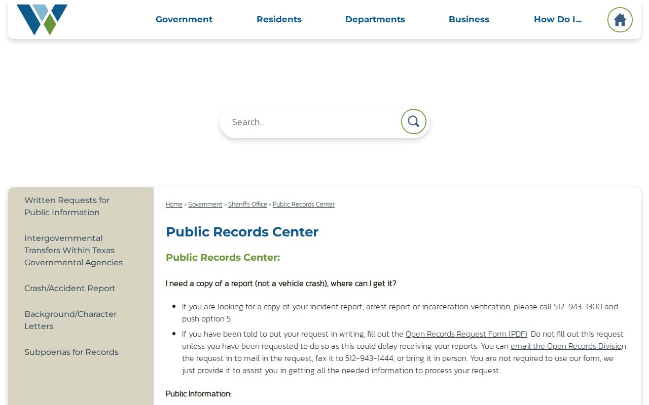
Use a specific record type, exact address, date range, and preferred format in a written request. The custodian can provide existing responsive records, but is not required to create a new block summary or conduct an open-ended search.
Note: When an address result conflicts with a postal-city label, compare the official GIS address, parcel ID, and legal description before requesting records.
Privacy Limits for Williamson County Neighbors
Some information around a parcel is not public or is protected. A map polygon is land geometry, not a list of people. Public property data may omit people who are not the taxable owner, and voter protections can suppress a residence address and other fields for qualifying individuals. Utility and delivery accounts, DMV residence data, unlisted contact details, and many city-account records are not ordinary public block records. Do not turn a gap in public data into a conclusion about a person.
Texas Address Confidentiality Program participants can use substitute-address and mail-forwarding protections when they qualify. The Texas Data Privacy and Security Act can give consumers rights concerning covered private-company data, but it does not erase the county’s underlying deed or tax record. When a record appears wrong, raise the correction with the custodian that maintains it rather than copying the error across sources.
Lawful use. Use parcel and public-record information for personal, lawful purposes. Never use a neighbor result to stalk, harass, intimidate, or harm another person.